 Cagliari Boat Tours
Sella del Diavolo From the Water: Coves, Caves and the Devil's Saddle
Every Cagliari boat tour is, one way or another, a tour of this headland: the limestone saddle the city grew up against, with the gulf's best water folded into its base. This Sella del Diavolo from the water guide walks the coastline stop by stop - what you are actually looking at from each one. When you are ready to see it from a deck, the Gulf of Cagliari boat tours comparison lines up the boats that run it.
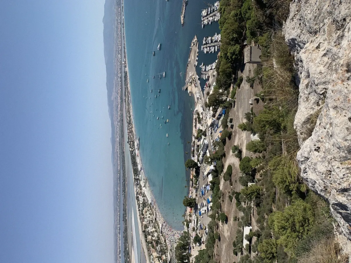
The saddle's own view: Poetto below, the gulf beyond - the geography every boat tour explains from the other side. Photo: Nilo1926, CC BY-SA 4.0, via Wikimedia Commons.0, via Wikimedia Commons.
Quick answer What the Devil's Saddle actually is, the stop-by-stop coast from Calamosca to Cala Bernat, and where the legend's devil left his mark
The Sella del Diavolo - the Devil's Saddle - is the limestone promontory that closes the Gulf of Cagliari's western end, rising about 135 metres between the 8 km Poetto beach and the open sea. Its seaward face is the reason Cagliari has a boat-tour industry at all: a two-kilometre cliff line folded with sea caves (Grotta dei Colombi the best known), pocket coves with no road access - Calamosca, Cala Mosca, Cala Fighera, Cala Bernat - and water that stays clear where the cliffs keep the crowds out. The name is the city's favourite legend: the devil, racing the archangels, fell to earth here and his saddle-shaped imprint stayed in the rock. From the water the saddle reads as exactly that - a rider's seat dropped on the cape's shoulder.
Key takeaways
- Four of the compared boats run this cliff line as their whole route - the flagship RIB swims four of its coves in one morning.
- The caves boat from Marina Piccola is the format built around the five-cave line specifically.
- Land legs work too: the Calamosca trail climbs the saddle itself - see the walking alternative before choosing a side.
- Land legs work too: the Calamosca trail climbs the saddle itself - see the walking alternative before choosing a side.
What the Sella del Diavolo Actually Is
Geologically, the headland is the seaward end of the same limestone spine that carries Cagliari's old town - Mesozoic rock, pale gold, soft enough for the sea to carve and hard enough to keep what it carves. The saddle shape that names it sits on the cape's summit ridge: two rises with a dip between them, unmistakable once seen from a boat's deck. Its height - about 135 metres - is enough to make the seaward cliffs dramatic without making them alpine, and enough for the landmark to function as the gulf's compass: every captain in the catalog uses the saddle as the day's reference point.
The landward side explains the boat routes too. Between the headland and the city runs the Poetto - the eight-kilometre beach that ends at the saddle's foot - and behind that the Molentargius wetlands. The coast south-west of the cape (Calamosca's side) faces the open mouth of the gulf; the north-eastern coves sit in its lee. Which coves swim well on a given day is, almost entirely, a question of which side the wind is on - the daily arithmetic every skipper in the comparison runs at dawn.
The Coves and Caves, Stop by Stop
Running the seaward face from west to east, the way the boats do it:
Calamosca. The cape's western shoulder - a small sheltered beach beloved by locals, a tower and a lighthouse, and the trailhead for the walk up the saddle. Clear, simple water; the first stop on routes heading out of Marina Piccola.
Cala Mosca. The snorkelling cove: rocky shelves drop into clean water, small schooling fish hold over the stone, and the entrance of Grotta dei Colombi stands within swimming distance. The boats that advertise marine life mean this stretch.
Grotta dei Colombi. The Pigeons' Cave - the largest named cavern on the line, its mouth wide enough for small boats to nose toward the dimness. Pigeons and swallows trade the ledges; the acoustics do the rest.
Cala Fighera. The hidden one - cliffs on three sides, a seasonal fisherman's hut, deep water off the rocks. The cove most visitors never see from land, and the swim stop guides are proudest of. How the boats time it differs by format.
Cala Bernat. The pebble pocket under the saddle's seaward shoulder - shallow over sand, green-gold in the sun, the classic first-stop swim of the RIB routes.
| Stop | What it is | The water | Best light |
|---|---|---|---|
| Calamosca | Locals' beach, tower and lighthouse, trailhead | Sandy shallows, gentlest entry | Morning |
| Cala Mosca | Snorkel shelf, schooling fish | Rocky, clear, fishy | Mid-morning |
| Grotta dei Colombi | The Pigeons' Cave, the line's big mouth | Deep-water float at the threshold | Midday sun angle |
| Cala Fighera | Hidden three-sided cove, seasonal hut | Deep, crystal, no shallows | Afternoon |
| Cala Bernat | Pebble pocket under the saddle | Shallow over sand, green-gold | First stop of the morning |
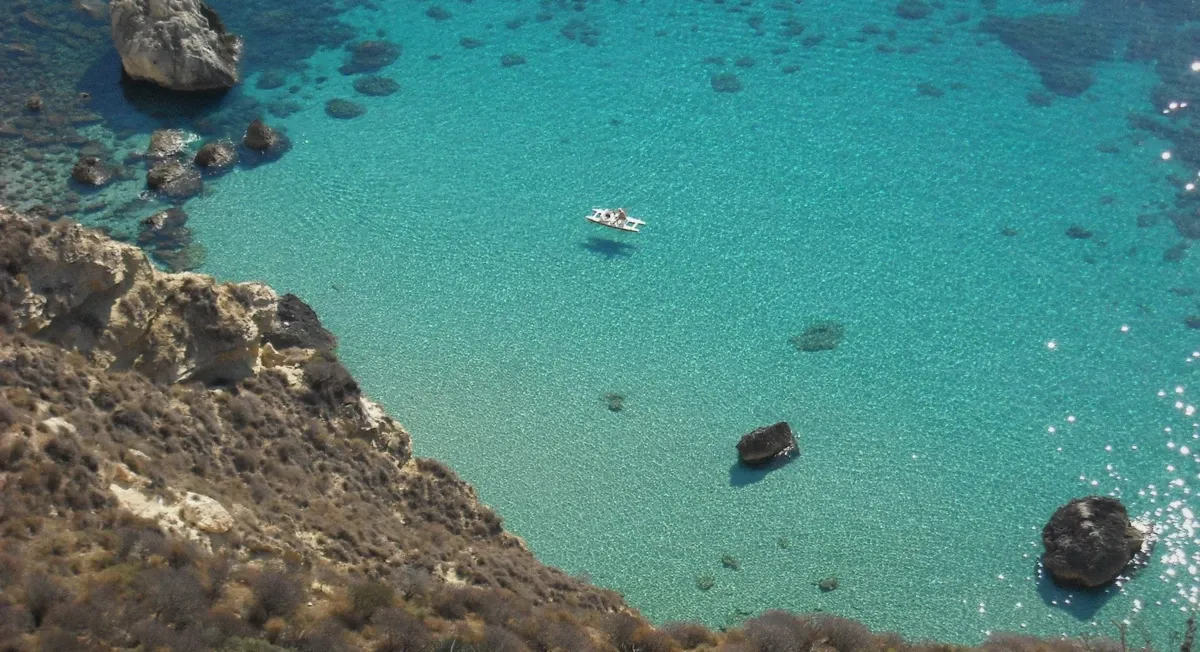
The saddle itself - two rises and a dip, the rider's seat that named the cape. Photo: cristianocani, CC BY 2.0, via Wikimedia Commons.0, via Wikimedia Commons.
The Legend on the Saddle
Cagliari tells it like this: the devil came for the city - some versions say drawn by its beauty, some by its bishop - and the archangels met him in the sky above the cape. In the fight he fell to earth, and where he landed the rock took the shape of his saddle. The imprint is the dip you can still pick out from a boat's deck, and the chapel on the summit path keeps the story alive on the landward side.
Like most good legends it does geography's work: the name turns a landmark into a story your skipper can point at, and every boat in the catalog tells some version of it - the storytelling Safari skipper builds his whole act around the coast's legends, the caves captain runs it with the geology, and the flagship's guides land it somewhere between the two. You will hear it at least once on any day under the headland; that is part of the ticket.
Seeing It from Land as Well
The saddle is walkable: the trail from Calamosca climbs through pines and scrub to the summit ridge in about forty-five minutes of moderate walking, with the coves you would have swum from appearing below one by one. The view from the top is the water's own argument in reverse - Poetto's 8 km running away to Quartu, the gulf's mouth open to the horizon, and the city stacked behind you. Bring real shoes and water; the descent is harder on the knees than the climb.
The honest comparison: walking gives you the saddle itself and the panorama; the boat gives you the caves, the deep-water coves and the swim. They are not substitutes - the trails end where the best water begins, which is why many visitors do both, boat in the morning and the Calamosca walk another day. The full-day sailing option is the format for travellers who want the coast beyond the saddle as well; the walk stays on this side of the cape.
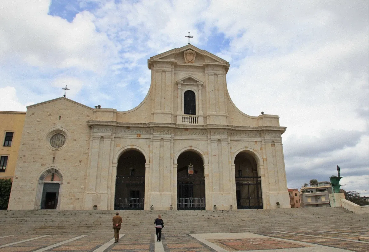
The Bonaria hill above the port - the city's other landmark on the boat approach. Photo: Holger Uwe Schmitt, CC BY-SA 4.0, via Wikimedia Commons.0, via Wikimedia Commons.
A Photograph at Every Stop
The headland photographs differently from every format in the water, and knowing which stop shoots which hour saves a memory card. Calamosca faces west: it owns the morning's calm light and the lighthouse-and-tower composition that anchors most route photos. Cala Mosca shoots best underwater - the rocky shelves and schooling fish are the gulf's reliable macro subject, best between the morning slots when the water is glassiest.
The Grotta dei Colombi is the drama shot: boat decks nose toward the mouth from mid-morning onward as the sun angle reaches inside, and the pigeon traffic on the ledges gives the wide lens its subject. Cala Fighera is the afternoon's - its three-sided cliffs hold shadow on one face and glow on the other once the sun leans west, which is when the sunset run passes it. Cala Bernat is the swimmers' proof shot: pebble clarity, green-gold shallows, best before the day's breeze roughens the surface.
And the saddle itself: the silhouette works from every deck but peaks from the Poetto side at dusk, when the rider's-seat shape reads black against the falling light - the shot the whole coast is named for, and the reason photographers forgive the evening formats their smaller swim count.
The Saddle Through the Season
The headland changes character four times a year, and the change decides which of its stops reward you. In late spring the cliff flowers hold on the seaward face and the water runs at its clearest - the cave mouths are at their most photogenic before the summer plankton haze, and the deck crowds are thin enough that the caves boat feels private.
High summer is the saddle at full volume: warm water for long swims at Cala Bernat and Fighera, every cave deck running multiple departures, and the afternoon breeze that pushes the smart money to morning boats. September is the connoisseur's month on this coast - summer water, autumn light angles that reach deeper into the caves, and cliff Line crowds back to civilised. October runs the same play with shorter days; by November the headland belongs to the climbers and the cormorants.
The winter saddle is worth naming because it explains the coast: bare, sharp, quietly magnificent from the Bastione terraces across the water - and the reason returning visitors book their first morning boat the moment the season reopens.
The Names on the Cliff
The headland's place-names are a short course in how Sardinia's coast was used, and the boats read them aloud stop by stop. Calamosca carries its tower and lighthouse - the Saracen-watch line that guarded this shore, and the pilots' marker that still opens the gulf's approaches. Cala Mosca - the 'fly cove' - keeps the working name of the small harbour life that fished these shelves. The Grotta dei Colombi's pigeons and swallows hold their cave the way their ancestors held it when the name was cut. Cala Fighera's 'fig cove' remembers the vegetation before the fishermen's hut; Cala Bernat's name rides the same Catalan wash that runs through Cagliari's older vocabulary - a reminder that this gulf was Pisan, Spanish and Sardinian in turn before it was Italian.
The saddle's own name rides the loudest story, but the summit carries quieter ones: the chapel path's stations, the quarry scars where the city's golden stone was cut, the war-era positions on the cape that watched a different sea. Skippers tell the legend because it lands; the cliff's other names are the conversation for the second swim stop, when the deck has settled and the coast starts answering questions.
Travellers who want the full read: the city-side view adds the quarry and the bastions' angle on the same stone, and an afternoon in Castello closes the loop the water opened - the gulf's geology is the old town's walls, stacked.
The Saddle from the City: Three Land Views
The headland is the city's favourite foreground, and three vantage points read it differently. The Bastione Saint Remy terraces, ten minutes' walk up from the port quarter, frame the saddle across the harbour water - the classic postcard angle, best in the morning when the cliffs face their light, and the city's original 'first view' for arrivals by sea and rail alike.
The Poetto shoreline reads the saddle in profile: from the western lidos the whole headland runs its full length, cliff to saddle to trailhead, with the beach in the foreground doing the scale work that makes the 135 metres land. Sunset from the sand is the photographer's alternative to the sunset run - the same silhouette, the same gold, a different vantage and no booking.
And the third view is the honest one: from the Calamosca trail, midway up the saddle itself, the city turns its back and the view becomes the gulf - the whole sailing ground of the comparison table spread below, the boats working the cove line at the scale of toys. Walkers who climb it once understand the boat routes permanently; the descent returns you to the trailhead's beach, where the swim that started all of it is exactly as clear as the decks promised.
The Coast on Foot: Pairing the Trail with the Boat
The headland rewards the double visit - one day by sea, one by trail - and the pairing has a grammar worth following. The boat day first: swimming the coves before knowing them from above gives the trail its references, and the cliff line's geography clicks into place at the first viewpoint when you can point at the water you swam. The reverse order works too, but the trail's views land differently once the coves have names attached.
The walk itself: start at Calamosca's beach road in the morning - the trailhead sits past the tower, marked and maintained - and climb through pine shade to the ridge in forty-five minutes of steady, moderate ground. The summit chapel, the quarry scars and the saddle's dip arrive in sequence; the gulf opens on the descent's lookouts, Poetto running its eight kilometres to Quartu below. Sturdy shoes, water, and a start before the heat are the whole requirements list.
And the closing option that ties the day in a knot: descend to Calamosca, swim off the tower beach, and watch the boat routes run the line you just walked - the deck's-eye view you now read from above. Few coastlines reward doing both halves this cleanly; this one was built for it.
Swimming the Coves: What the Water Is Like at Each Stop
The cove line reads differently underwater at every stop, and swimmers who know the sequence get more from each. Calamosca's beach water is the gentle entry: sandy shallows sloping to the tower's rocks, warmest of the line, where nervous swimmers find their feet. Cala Bernat runs the pebbles: clear green-gold over stone, a deeper drop just past the pocket's mouth, and the fish the shallows gather at the first mask's descent.
Cala Mosca is the snorkel stop without competition: rocky shelves, the schooling salema that turn with the light, and the Colombi cave's mouth within a comfortable swim for anyone guided by the crew's line. Cala Fighera is the deep-water swim - cliffs on three sides, no shallows to stand on, water so clear the boat's shadow reads on the bottom - the cove that converts confident swimmers into repeat visitors.
The rules that keep it perfect are few: no touching the posidonia meadows where they edge the coves, fins pointed away from other swimmers at the ladder, and the crew's line between the boat and the cliff respected on busy days. Follow those and the season's best water - June's clarity, September's warmth - is yours at whichever stop the captain names.
Questions About the Headland
Why is it called Sella del Diavolo?
From the city's founding legend: the devil fought the archangels over Cagliari, fell to earth on the cape, and the saddle-shaped imprint of his fall stayed in the summit rock. The dip is still visible from the water, and every boat guide on this coast tells some version of the story.
How high is the Sella del Diavolo?
About 135 metres - recorded in the Wikidata entry for the promontory and visible in the way it closes the gulf's skyline. From a boat's deck it reads as a steep golden wall with a saddle on top; from the summit, Poetto runs 8 km away below.
Can you hike the Sella del Diavolo?
Yes - the Calamosca trail climbs to the summit in about 45 minutes of moderate walking, passing the small chapel near the top. It is the land answer to the boat routes: real views, no swim. Sturdy shoes and water are the price of entry.
What caves are around the Sella del Diavolo?
A line of sea caves threads the seaward cliff base - Grotta dei Colombi (the Pigeons' Cave) is the named star, with smaller wave-cut caverns and arches either side. The Marina Piccola caves boat is the format built around visiting five of them.
Which boat tour goes around the Sella del Diavolo?
Most of them: the two RIB safaris, the caves boat, the catamarans and the sunset run all work its coastline - the comparison table sorts the nine by route and price. The private gozzo and the full-day yacht extend beyond it; the cave-and-cove line itself is the shared heart of the catalog.
Can you swim at Cala Fighera?
Yes - deep water entry off the rocks, cliffs on three sides, and water that stays clear because nothing roads into the cove. It is a boat-access swim in practice: the cliff path down is rough, and the RIB routes make it their centrepiece stop.
Is the Sella del Diavolo hike safe for children?
The lower trail suits school-age walkers in real shoes; the summit ridge is the sensible turning point for younger crews. Sun and the exposed scree are the genuine hazards - carry water, go early, and treat the coves below as the boat-day reward rather than a climbing target.
Which is better: hiking the saddle or the boat tour?
They are different days: the hike owns the view and the exercise; the boats own the caves, the coves and the swim. Most visitors who have the time do one of each - the comparison table prices the boat side, and the trailhead at Calamosca is where the walking side starts.
Where does the Sella del Diavolo name come from originally?
From the saddle-shaped dip in the summit ridge, which the city's legend reads as the imprint of the devil's fall after his fight with the archangels. The shape is real geology; the story is Cagliari's favourite - and every boat guide on this coast tells some version of it.
Can you see the Sella del Diavolo from Poetto beach?
In full profile - the headland closes the beach's western end, and from the sand the whole cliff-to-saddle line reads at its longest. Sunset from the western lidos is the land-based twin of the evening boat runs, with the same silhouette and no booking.